Photos • Location
Gachsaran Airport | |||||||||||
|---|---|---|---|---|---|---|---|---|---|---|---|
| Summary | |||||||||||
| Owner | Government of Iran | ||||||||||
| Operator | Iran Airports Company | ||||||||||
| Serves | Gachsaran, Iran | ||||||||||
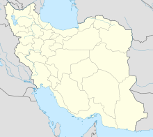
| Coordinates | 30°20′15″N 050°49′41″E / 30.33750°N 50.82806°E | ||||||||||
| Map | |||||||||||
| Runways | |||||||||||
| |||||||||||
Gachsaran Airport ( IATA: GCH, ICAO: OIAH) is an airport serving Dogonbadan (Gachsaran), Iran. It is located in Kohgiluyeh and Boyer-Ahmad province. [3]
Airlines and destinations
| Airlines | Destinations |
|---|---|
| Mahan Air | Tehran–Mehrabad |
| Pars Air | Tehran–Mehrabad |
References
- ^ Airport information for OIAH at Great Circle Mapper.
- ^ Airport information for Gachsaran Airport at Transport Search website.
- ^ "List of all airports in Iran". The Airport Authority. Retrieved 2019-01-02.
