Photos • Location
Location of
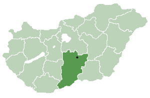
Bács-Kiskun county in
Hungary

Géderlak | |
|---|---|
| Coordinates: 46°37′N 18°55′E / 46.617°N 18.917°E | |
| Country | |
| County | Bács-Kiskun |
| Area | |
| • Total | 18.72 km2 (7.23 sq mi) |
| Population (2015) | |
| • Total | 997 [1] |
| • Density | 53.2/km2 (138/sq mi) |
| Time zone | UTC+1 ( CET) |
| • Summer ( DST) | UTC+2 ( CEST) |
| Postal code | 6334 |
| Area code | 78 |

Géderlak ( Croatian: Gider) is a village in Bács-Kiskun county, in the Southern Great Plain region of southern Hungary.
Geography
It covers an area of 27.93 km2 (11 sq mi) and has a population of 997 people (2015). [1]
References
- ^ a b Gazetteer of Hungary, 1 January 2015. Hungarian Central Statistical Office. 3 September 2015


46°37′N 18°55′E / 46.617°N 18.917°E
|
| This Bács-Kiskun location article is a stub. You can help Wikipedia by expanding it. |