Photos • Location


Size of this preview:
799 × 375 pixels. Other resolutions:
320 × 150 pixels |
640 × 300 pixels |
1,502 × 705 pixels.
Original file (1,502 × 705 pixels, file size: 389 KB, MIME type: image/jpeg)
| This is a file from the
Wikimedia Commons. Information from its
description page there is shown below. Commons is a freely licensed media file repository. You can help. |
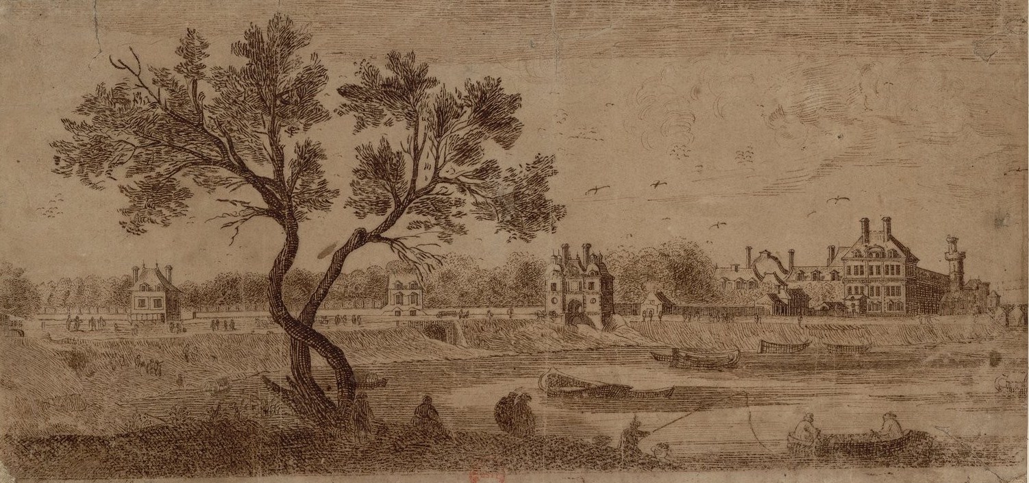
| Description | Vue et perspective du jardin des Tuileries. Sur la droite, la tour du Bois. | ||||
| Date | |||||
| Source |
Bibliothèque nationale de France |
||||
| Author | drawing by Israel Silvestre | ||||
| Permission ( Reusing this file) |
|
| Camera location | | View this and other nearby images on: OpenStreetMap |
|
|---|
| Annotations | This image is annotated: View the annotations at Commons |
File history
Click on a date/time to view the file as it appeared at that time.
| Date/Time | Thumbnail | Dimensions | User | Comment | |
|---|---|---|---|---|---|
| current | 20:54, 13 August 2015 |
| 1,502 × 705 (389 KB) | Tangopaso | Larger image and better definition |
| 10:17, 12 February 2015 |
 | 747 × 364 (69 KB) | Mini.fb | Recadrage. | |
| 17:57, 12 February 2011 |
 | 768 × 437 (64 KB) | Tangopaso | {{Information |Description=Vue et perspective du jardin des Tuileries. Sur la droite, la tour du Bois. |Source=http://gallica.bnf.fr/ark:/12148/btv1b7744876t |Date= |Author=drawing by Israel Silvestre |Permission={{PD-GallicaScan}} |other_versions= }} {{l |
File usage
The following pages on the English Wikipedia use this file (pages on other projects are not listed):
Global file usage
The following other wikis use this file:
- Usage on fr.wikipedia.org