Photos • Location


Size of this preview:
800 × 442 pixels. Other resolutions:
320 × 177 pixels |
640 × 354 pixels |
1,024 × 566 pixels |
1,602 × 886 pixels.
Original file (1,602 × 886 pixels, file size: 282 KB, MIME type: image/jpeg)
| This is a file from the
Wikimedia Commons. Information from its
description page there is shown below. Commons is a freely licensed media file repository. You can help. |
Summary
| Description |
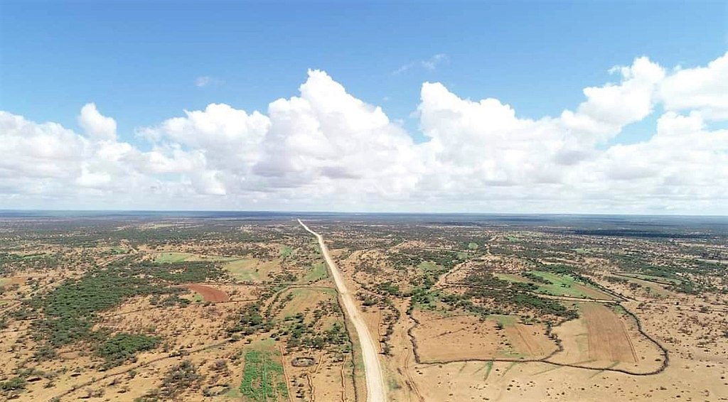
English: The road from the capital Hargeisa to Baligubadle on the Ethiopian border through the Hawd plain. People have illegaly enclosed many of the more fertile patches, obstructing seasonal cattle herding. The picture was taken just north of the village of Gumburaha. |
|||||
| Date | ||||||
| Source | https://goo.gl/maps/3sZ9dQKZ7aZbPnvR8 | |||||
| Author | Wacdiyo Waano | |||||
| Permission ( Reusing this file) |
|


.jpg)
Picture taken just north of the village of Gumburaha, looking north, here:
| Camera location |
| View this and other nearby images on: OpenStreetMap |
|
|---|
.jpg¶ms=009.181022_N_0044.022539_E_globe:Earth_type:camera__&language=en)
File history
Click on a date/time to view the file as it appeared at that time.
| Date/Time | Thumbnail | Dimensions | User | Comment | |
|---|---|---|---|---|---|
| current | 13:51, 14 May 2021 |
| 1,602 × 886 (282 KB) | Loranchet | == {{int:filedesc}} == {{Information |Description ={{en|1=The road from the capital Hargeisa to Baligubadle on the Ethiopian border through the Hawd plain. People have illegaly enclosed many of the more fertile patches, obstructing seasonal cattle herding. The picture was taken just north of the village of Gumburaha.}} |Source =https://goo.gl/maps/3sZ9dQKZ7aZbPnvR8 |Author =Wacdiyo Waano |Date =December 2020 |Permission ={{PD-Somaliland}} |other_versions = }}... |
File usage
The following pages on the English Wikipedia use this file (pages on other projects are not listed):
Global file usage
The following other wikis use this file:
- Usage on fi.wikipedia.org
- Usage on nl.wikipedia.org
.jpg)