Size of this preview:
600 × 600 pixels. Other resolutions:
240 × 240 pixels |
480 × 480 pixels |
768 × 768 pixels |
1,024 × 1,024 pixels |
2,048 × 2,048 pixels |
7,500 × 7,500 pixels.
Original file (7,500 × 7,500 pixels, file size: 3.49 MB, MIME type: image/jpeg)
| This is a file from the
Wikimedia Commons. Information from its
description page there is shown below. Commons is a freely licensed media file repository. You can help. |
Summary
| Description |
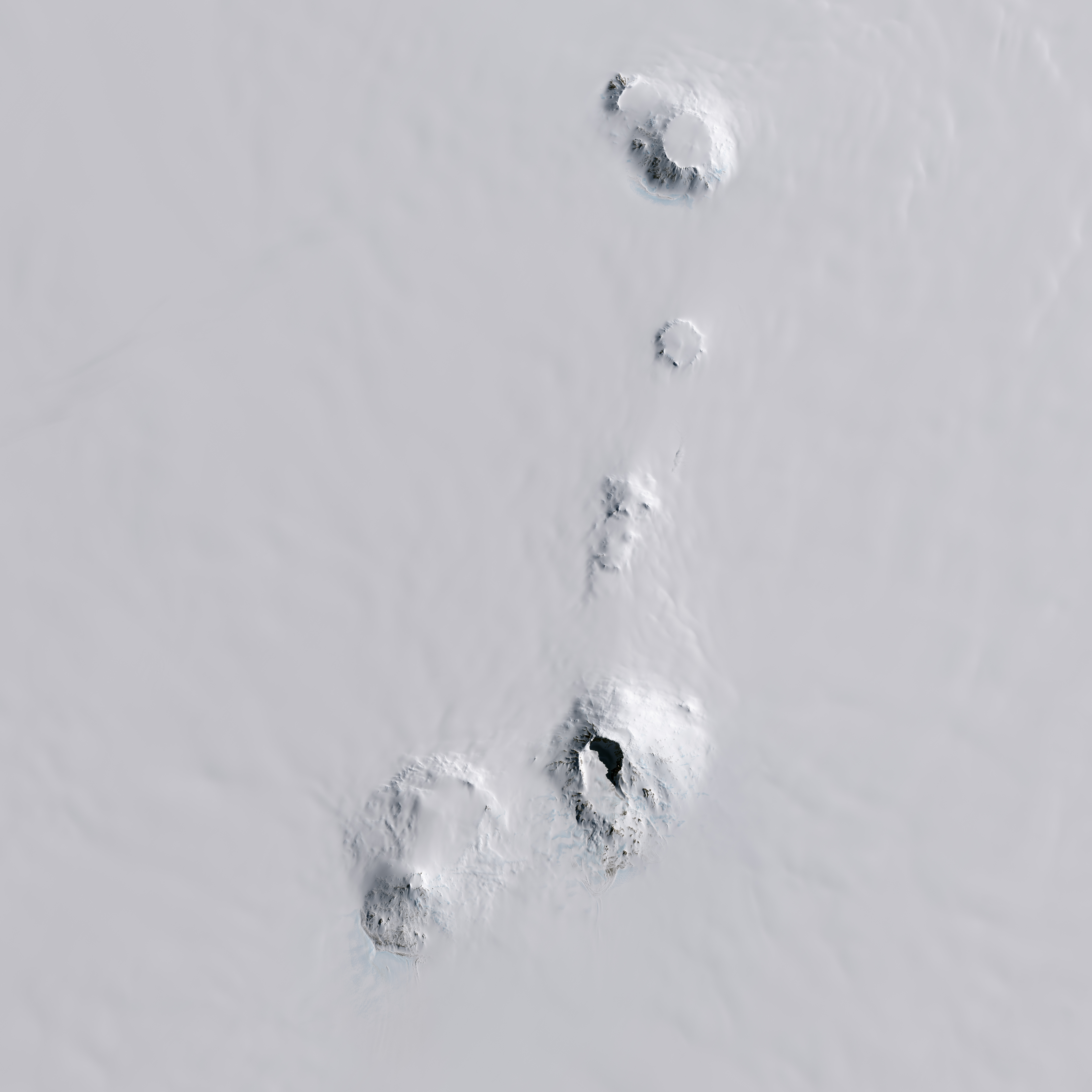
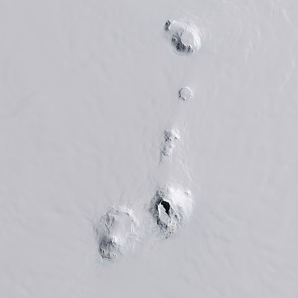
English: These images of
Mount Sidley were acquired on November 20, 2014, by the Operational Land Imager (OLI) on Landsat 8. The volcano stands about 4,200 meters (13,800 feet) above sea level and 2,200 meters (7,200 feet) above ice level. The caldera wall, which is mostly shadowed in this image, is about 1,200 meters (3,900 feet) high. The caldera floor spans 5 kilometers (3 miles).
Sidley is one of five volcanoes in the Executive Committee Range, which stretches about 80 kilometers (50 miles) from north to south. |
| Date | |
| Source | http://earthobservatory.nasa.gov/IOTD/view.php?id=85238 |
| Author | NASA Earth Observatory image by Jesse Allen, using Landsat data from the U.S. Geological Survey. Caption by Kathryn Hansen. |
Licensing
| This file is in the public domain in the United States because it was solely created by NASA. NASA copyright policy states that "NASA material is not protected by copyright unless noted". (See Template:PD-USGov, NASA copyright policy page or JPL Image Use Policy.) | ||
 |
Warnings:
|
File history
Click on a date/time to view the file as it appeared at that time.
| Date/Time | Thumbnail | Dimensions | User | Comment | |
|---|---|---|---|---|---|
| current | 00:12, 8 February 2015 |
| 7,500 × 7,500 (3.49 MB) | Melikamp | User created page with UploadWizard |
File usage
The following pages on the English Wikipedia use this file (pages on other projects are not listed):
Global file usage
The following other wikis use this file:
- Usage on af.wikipedia.org
- Usage on ar.wikipedia.org
- Usage on ceb.wikipedia.org
- Usage on de.wikipedia.org
- Usage on fr.wikipedia.org
- Usage on ja.wikipedia.org
- Usage on nn.wikipedia.org
- Usage on no.wikipedia.org
- Usage on pl.wikipedia.org
- Usage on www.wikidata.org