Size of this preview:
425 × 599 pixels. Other resolutions:
170 × 240 pixels |
341 × 480 pixels |
545 × 768 pixels |
1,235 × 1,740 pixels.
Original file (1,235 × 1,740 pixels, file size: 1.8 MB, MIME type: image/jpeg)
Summary
| Description |
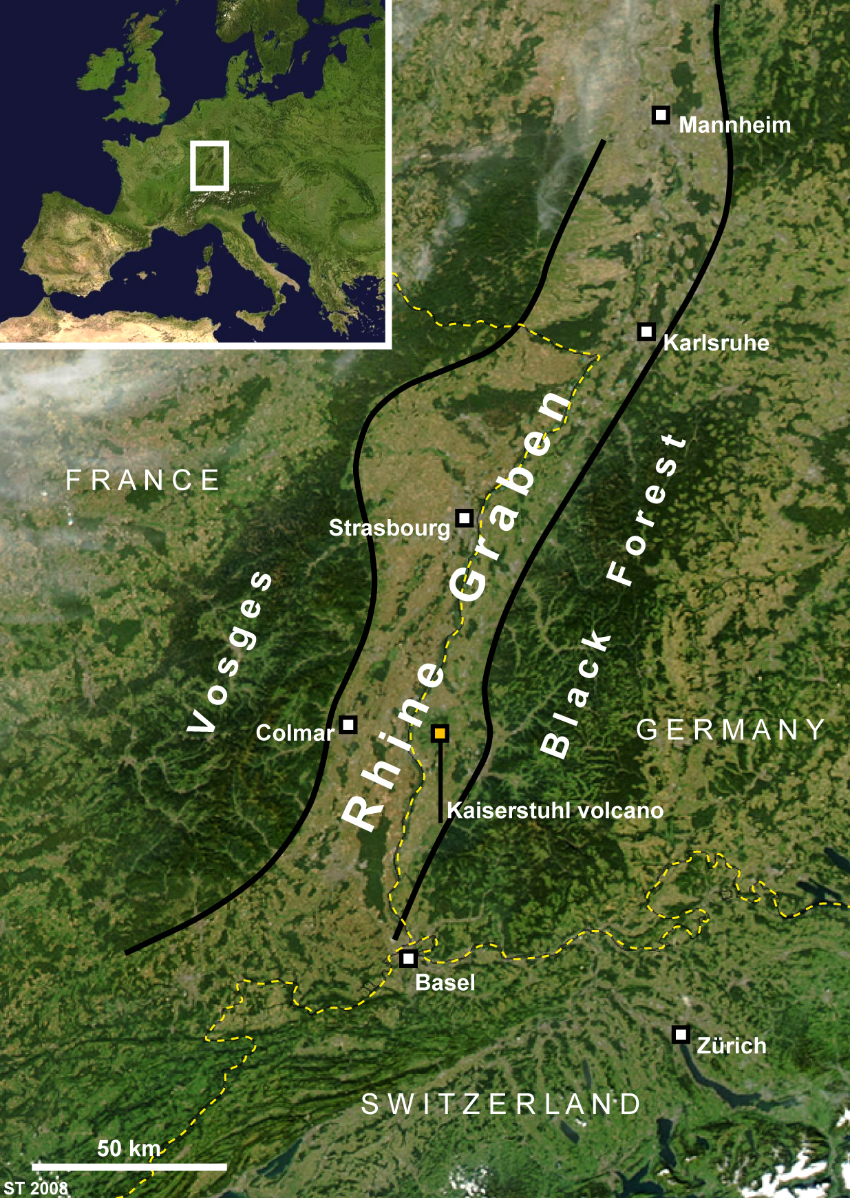
Map of the Rhine Graben, Central Europe |
|---|---|
| Source |
self-made |
| Date |
April 2008 |
| Author |
Seb Turner |
| Permission ( Reusing this file) |
See below.
|
Licensing:
| I, the copyright holder of this work, hereby release it into the
public domain. This applies worldwide. If this is not legally possible: |
 | This file is a candidate to be copied to
Wikimedia Commons.
Any user may perform this transfer; refer to Wikipedia:Moving files to Commons for details. If this file has problems with attribution, copyright, or is otherwise ineligible for Commons, then remove this tag and DO NOT transfer it; repeat violators may be blocked from editing. Other Instructions
| ||
| |||
File history
Click on a date/time to view the file as it appeared at that time.
| Date/Time | Thumbnail | Dimensions | User | Comment | |
|---|---|---|---|---|---|
| current | 14:59, 28 April 2008 |
| 1,235 × 1,740 (1.8 MB) | Sebturner ( talk | contribs) | {{Information |Description=Map of the Rhine Graben, Central Europe |Source=self-made |Date=April 2008 |Author=Seb Turner |other_versions= }} |
You cannot overwrite this file.
File usage
The following pages on the English Wikipedia use this file (pages on other projects are not listed):