Size of this preview:
667 × 600 pixels. Other resolutions:
267 × 240 pixels |
534 × 480 pixels |
854 × 768 pixels |
1,033 × 929 pixels.
Original file (1,033 × 929 pixels, file size: 142 KB, MIME type: image/png)
| This is a file from the
Wikimedia Commons. Information from its
description page there is shown below. Commons is a freely licensed media file repository. You can help. |
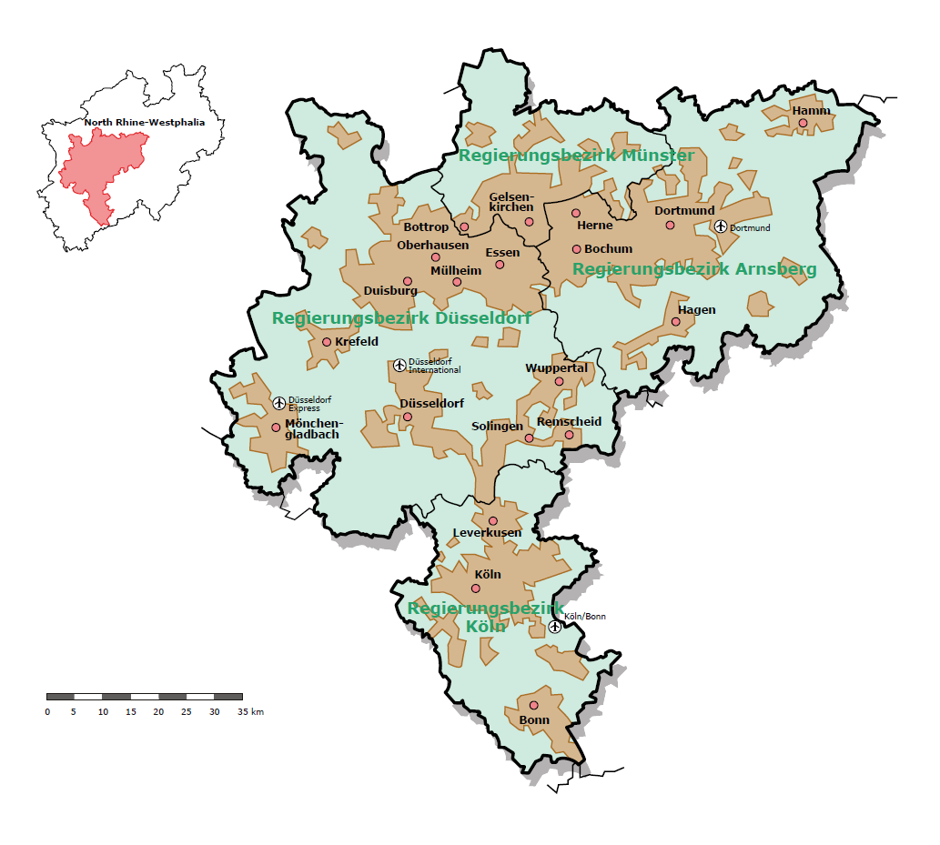
| Description | Map of the Rhein-Ruhr metropolitan region | |||
| Date | ||||
| Source | http://www.brd.nrw.de/BezRegDdorf/hierarchie/themen/Planung_und_Kommunales/Statistische_Daten/m_Die_Zukunft_gehoert_der_Metropolregion.php | |||
| Author | Bezirksregierung Düsseldorf | |||
| Permission ( Reusing this file) |
|
|||
| Other versions |
|


File history
Click on a date/time to view the file as it appeared at that time.
| Date/Time | Thumbnail | Dimensions | User | Comment | |
|---|---|---|---|---|---|
| current | 17:17, 9 June 2009 |
| 1,033 × 929 (142 KB) | Foundert~commonswiki | {{Information |Description=Map of the Rhein-Ruhr metropolitan region |Source=http://www.brd.nrw.de/BezRegDdorf/hierarchie/themen/Planung_und_Kommunales/Statistische_Daten/m_Die_Zukunft_gehoert_der_Metropolregion.php |Date=1995 |Author=Bezirksregierung Dü |
File usage
The following pages on the English Wikipedia use this file (pages on other projects are not listed):
Global file usage
The following other wikis use this file:
- Usage on az.wikipedia.org
- Usage on ca.wikipedia.org
- Usage on de.wikipedia.org
- Usage on eo.wikipedia.org
- Usage on es.wikipedia.org
- Usage on et.wikipedia.org
- Usage on fa.wikipedia.org
- Usage on frr.wikipedia.org
- Usage on hy.wikipedia.org
- Usage on id.wikipedia.org
- Usage on is.wikipedia.org
- Usage on it.wikipedia.org
- Usage on mk.wikipedia.org
- Usage on ru.wikinews.org
- Usage on tl.wikipedia.org
- Usage on tr.wikipedia.org
- Usage on ur.wikipedia.org
- Usage on vi.wikipedia.org
- Usage on www.wikidata.org
- Usage on zh.wikipedia.org