
Size of this preview:
718 × 600 pixels. Other resolutions:
288 × 240 pixels |
575 × 480 pixels |
920 × 768 pixels |
1,226 × 1,024 pixels |
2,453 × 2,048 pixels |
4,400 × 3,674 pixels.
Original file (4,400 × 3,674 pixels, file size: 4.54 MB, MIME type: image/jpeg)
| This is a file from the
Wikimedia Commons. Information from its
description page there is shown below. Commons is a freely licensed media file repository. You can help. |
Summary
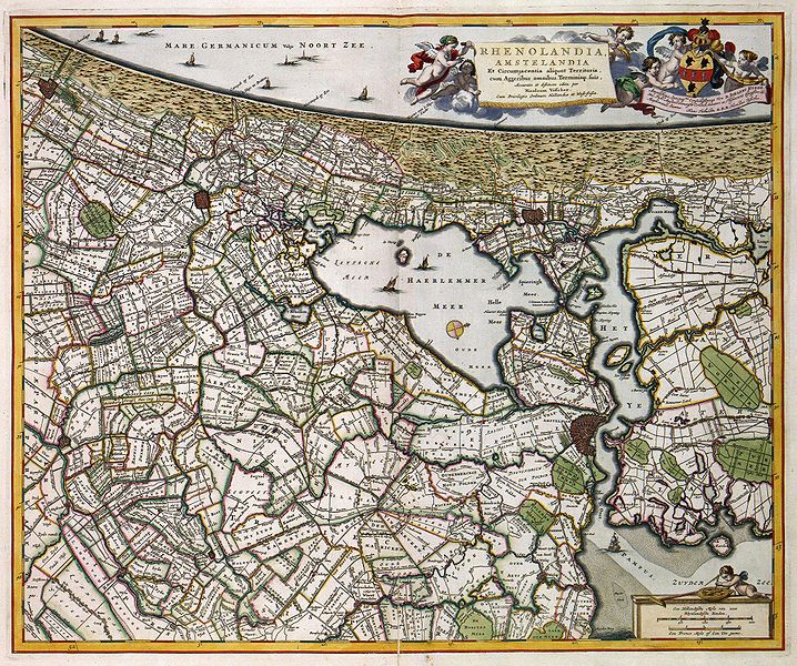
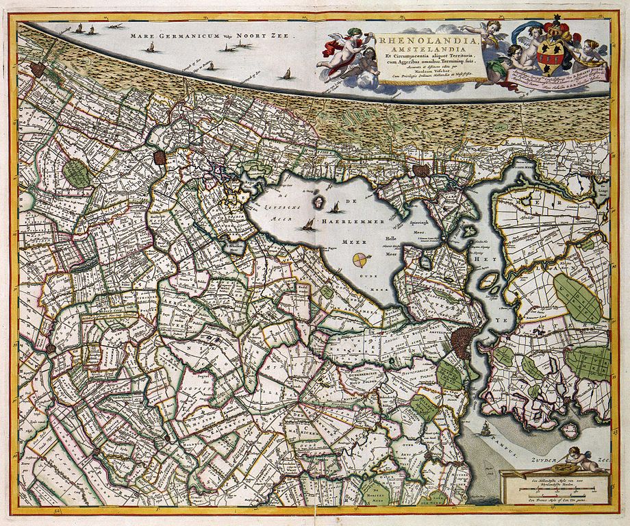
| Description | RHENOLANDIA, AMSTELANDIA Et Circumjacentia aliquot Territoria, cum Aggeribus omnibus Terminisq: suis, Accurate et distincte edita (historic map of Rijnland and Amstelland, Holland) |
| Date | |
| Source | www.geheugenvannederland.nl |
| Author | Nicolaas Visscher |
Licensing
|
This work is in the public domain in its country of origin and other countries and areas where the copyright term is the author's life plus 100 years or fewer. | |
| This file has been identified as being free of known restrictions under copyright law, including all related and neighboring rights. | |
File history
Click on a date/time to view the file as it appeared at that time.
| Date/Time | Thumbnail | Dimensions | User | Comment | |
|---|---|---|---|---|---|
| current | 16:13, 4 January 2008 |
| 4,400 × 3,674 (4.54 MB) | P199 | == Summary == {{Information |Description=''RHENOLANDIA, AMSTELANDIA Et Circumjacentia aliquot Territoria, cum Aggeribus omnibus Terminisq: suis, Accurate et distincte edita'' (historic map of Rijnland and Amstelland, Holland) |Source=www.geheugenvannederl |
File usage
The following pages on the English Wikipedia use this file (pages on other projects are not listed):
Global file usage
The following other wikis use this file:
- Usage on ca.wikipedia.org
- Usage on es.wikipedia.org
- Usage on fr.wikipedia.org
- Usage on hu.wikipedia.org
- Usage on it.wikipedia.org
- Usage on nn.wikipedia.org
- Usage on no.wikipedia.org
- Usage on ro.wikipedia.org
- Usage on ru.wikipedia.org
- Usage on sl.wikipedia.org