Punjab_in_India.png (350 × 426 pixels, file size: 76 KB, MIME type: image/png)
| This is a file from the
Wikimedia Commons. Information from its
description page there is shown below. Commons is a freely licensed media file repository. You can help. |
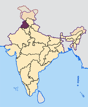
Map made by me, Nichalp
Note: The Indian state of w:Jammu and Kashmir is claimed by w:India, w:Pakistan and the w:People's Republic of China. This map depicts the boundaries of the state as it was in 1947. Areas administered by India is coloured as per the rest of the states, and the area administered by Pakistan and China are coloured in a neutral colour. See the map of Jammu and Kashmir.
The Indian state of w:Arunachal Pradesh is claimed by China as a part of w:South Tibet. The claimed region is depicted in a pale shade of pink. See the map of Arunachal Pradesh.
The Indian territorial waters extend to a distance of twelve nautical miles.

|
Permission is granted to copy, distribute and/or modify this document under the terms of the GNU Free Documentation License, Version 1.2 or any later version published by the Free Software Foundation; with no Invariant Sections, no Front-Cover Texts, and no Back-Cover Texts. A copy of the license is included in the section entitled GNU Free Documentation License. |
| This file is licensed under the Creative Commons Attribution-Share Alike 3.0 Unported license. | ||
| ||
| This licensing tag was added to this file as part of the GFDL licensing update. |
File history
Click on a date/time to view the file as it appeared at that time.
| Date/Time | Thumbnail | Dimensions | User | Comment | |
|---|---|---|---|---|---|
| current | 07:33, 23 April 2005 |
| 350 × 426 (76 KB) | Nichalp | NPOV map |
| 07:22, 23 April 2005 |
 | 200 × 231 (22 KB) | Kerpal | Reverted to earlier revision | |
| 06:27, 23 April 2005 |
 | 500 × 608 (121 KB) | Nichalp | Reverted to earlier revision | |
| 05:00, 23 April 2005 |
 | 200 × 231 (22 KB) | Kerpal | Reverted to earlier revision | |
| 04:54, 23 April 2005 |
 | 500 × 608 (121 KB) | Nichalp | Reverted to earlier revision | |
| 21:06, 22 April 2005 |
 | 200 × 231 (22 KB) | Kerpal | Reverted to earlier revision | |
| 13:38, 22 April 2005 |
 | 500 × 608 (121 KB) | Nichalp | Reverted to earlier revision | |
| 09:43, 22 April 2005 |
 | 200 × 231 (22 KB) | Kerpal | originally by en:User:Morwen | |
| 18:06, 21 April 2005 |
 | 500 × 608 (121 KB) | Nichalp | ---- Map made by me, ~~~ ---- Note: The Indian state of w:Jammu and Kashmir is claimed by w:India, w:Pakistan and the w:People's Republic of China. This map depicts the boundaries of the state as it was in 1947. Areas administered by Indi |
File usage
More than 100 pages use this file. The following list shows the first 100 pages that use this file only. A full list is available.
- 2012 elections in India
- Aawat pauni
- Amritsar
- Amritsar Metrobus
- Amritsar district
- Aulakh, Muktsar
- Barnala district
- Basant (festival)
- Bathinda
- Bathinda district
- Bhai Rupa
- Bhangra (dance)
- Bhangra (music)
- Bhanupli–Leh line
- Chandigarh
- Chhapar Mela
- Demographics of Punjab, India
- Dhandwar
- Dharam Yudh Morcha
- Doaba
- Economy of Punjab, India
- Education in Punjab, India
- Faridkot, India
- Faridkot district
- Fatehgarh Sahib district
- Fazilka district
- Firozpur district
- Folk dances of Punjab
- Folk music of Punjab
- Gaggon
- Ganga Ram
- Gogaji
- Greater Mohali
- Gurdaspur district
- Gurmukhi
- Hoshiarpur district
- Jalandhar
- Jalandhar district
- Jalandhar–Jammu line
- Jutti
- Kapurthala district
- List of Hindu festivals in Punjab
- List of Sikh festivals
- List of fairs and festivals in Punjab, India
- List of villages in Ludhiana East tehsil
- List of villages in Ludhiana West tehsil
- Lohri
- Ludhiana
- Ludhiana Bus Rapid Transit System
- Ludhiana district
- Maghi
- Majha
- Malwa (Punjab)
- Mansa, Punjab
- Mansa district, India
- Moga, Punjab
- Moga district
- Mohali
- Mohali district
- Music of Punjab
- Nanakshahi calendar
- Pathankot
- Pathankot district
- Patiala
- Patiala district
- Patiala salwar
- Phulkari
- Puadh
- Punjab
- Punjab, India
- Punjab Police (India)
- Punjabi Qisse
- Punjabi Suba movement
- Punjabi Tamba and Kurta
- Punjabi bhathi
- Punjabi calendar
- Punjabi clothing
- Punjabi cuisine
- Punjabi culture
- Punjabi ghagra suit
- Punjabi kabaddi
- Punjabi tandoori cooking
- Punjabis
- Religion in the Punjab
- Roshni mela
- Rupnagar district
- Sakhi Sarwar (saint)
- Sangrur
- Sangrur district
- Sanjhi
- Seetla Mata, Punjab
- Shaheed Bhagat Singh Nagar district
- Sports in Punjab
- Sports in Punjab, India
- Sri Muktsar Sahib district
- Tarn Taran district
- Teeyan
- Vaisakhi
- Yadavindra Singh
- Template:Punjab, India
View more links to this file.
Global file usage
The following other wikis use this file:
- Usage on awa.wikipedia.org
- Usage on bh.wikipedia.org
- अमृतसर जिला
- बरनाला जिला
- भटिंडा जिला
- फिरोजपुर जिला
- फरीदकोट जिला
- फतेहगढ़ साहिब जिला
- फजिल्का जिला
- गुरदासपुर जिला
- होशियारपुर जिला
- जालंधर जिला
- कपूरथला जिला
- लुधियाना जिला
- मानसा जिला
- मोगा जिला
- श्री मुक्तसर साहिब जिला
- पठानकोट जिला
- पटियाला जिला
- रूपनगर जिला
- संगरूर जिला
- शहीद भगत सिंह नगर जिला
- तरनतारन जिला
- टेम्पलेट:पंजाब
- Usage on bn.wikipedia.org
- Usage on bxr.wikipedia.org
- Usage on hi.wikipedia.org
View more global usage of this file.