
Size of this preview:
441 × 600 pixels. Other resolutions:
176 × 240 pixels |
353 × 480 pixels |
565 × 768 pixels |
753 × 1,024 pixels |
1,506 × 2,048 pixels |
5,752 × 7,822 pixels.
Original file (5,752 × 7,822 pixels, file size: 34.75 MB, MIME type: image/jpeg)
| This is a file from the
Wikimedia Commons. Information from its
description page there is shown below. Commons is a freely licensed media file repository. You can help. |
Summary
| Description |
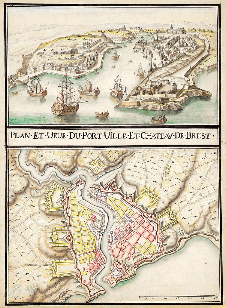
English: Project plan of the fortifications of the city of Brest. In the military fortification plan of this period, by convention, the existing parts are in magenta / red and the project parts are in yellow.
Above the map there is a copy of the cavalier view of the city of Brest by Antoine Aveline.
Français : Plan projet des fortifications de la ville de Brest. Dans les plan de fortification militaires de cette époque, par convention, les parties existante sont en magenta, les bâtiments militaires sont en bleu et les parties projet sont en jaune.
Ce plan est donc probablement d’origine militaire. Au dessus de la carte figure une copie de la vue cavalière de la ville de Brest d'Antoine Aveline. |
| Date | circa 1700 |
| Source | Division 4 du portefeuille 47 du Service hydrographique de la marine consacrée à Brest: ville, fort et port. |
| Author | Unknown et Antoine Aveline |
| Other versions |
|

Assessment
|
Licensing
|
This work is in the public domain in its country of origin and other countries and areas where the copyright term is the author's life plus 70 years or fewer. This work is in the public domain in the United States because it was published (or registered with the U.S. Copyright Office) before January 1, 1929. | |
| This file has been identified as being free of known restrictions under copyright law, including all related and neighboring rights. | |
File history
Click on a date/time to view the file as it appeared at that time.
| Date/Time | Thumbnail | Dimensions | User | Comment | |
|---|---|---|---|---|---|
| current | 16:11, 28 October 2018 |
| 5,752 × 7,822 (34.75 MB) | S. DÉNIEL | User created page with UploadWizard |
File usage
The following pages on the English Wikipedia use this file (pages on other projects are not listed):
Global file usage
The following other wikis use this file:
- Usage on fr.wikipedia.org
- Usage on su.wikipedia.org
- Usage on uk.wikipedia.org