No higher resolution available.
Mississippi_River_Watershed_Map_North_America.png (800 × 494 pixels, file size: 260 KB, MIME type: image/png)
| This is a file from the
Wikimedia Commons. Information from its
description page there is shown below. Commons is a freely licensed media file repository. You can help. |
Summary
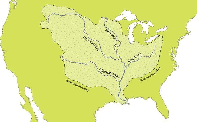
| Description |
English: Map of the Mississippi River watershed |
| Date | |
| Source | http://www.nps.gov/miss/riverfacts.htm |
| Author | National Park Service |
Licensing
| This image or media file contains material based on a work of a National Park Service employee, created as part of that person's official duties. As a work of the U.S. federal government, such work is in the public domain in the United States. See the NPS website and NPS copyright policy for more information. |
File history
Click on a date/time to view the file as it appeared at that time.
| Date/Time | Thumbnail | Dimensions | User | Comment | |
|---|---|---|---|---|---|
| current | 02:37, 24 December 2019 |
| 800 × 494 (260 KB) | Myrhonon | User created page with UploadWizard |
File usage
The following pages on the English Wikipedia use this file (pages on other projects are not listed):
Global file usage
The following other wikis use this file:
- Usage on as.wikipedia.org
- Usage on bh.wikipedia.org
- Usage on es.wikipedia.org
- Usage on kbp.wikipedia.org
- Usage on pl.wiktionary.org
- Usage on sc.wikipedia.org
- Usage on simple.wikipedia.org