Photos • Location


Size of this preview:
600 × 600 pixels. Other resolutions:
240 × 240 pixels |
480 × 480 pixels |
768 × 768 pixels |
1,024 × 1,024 pixels |
2,400 × 2,400 pixels.
Original file (2,400 × 2,400 pixels, file size: 3.01 MB, MIME type: image/jpeg)
| This is a file from the
Wikimedia Commons. Information from its
description page there is shown below. Commons is a freely licensed media file repository. You can help. |
Summary
| Description |
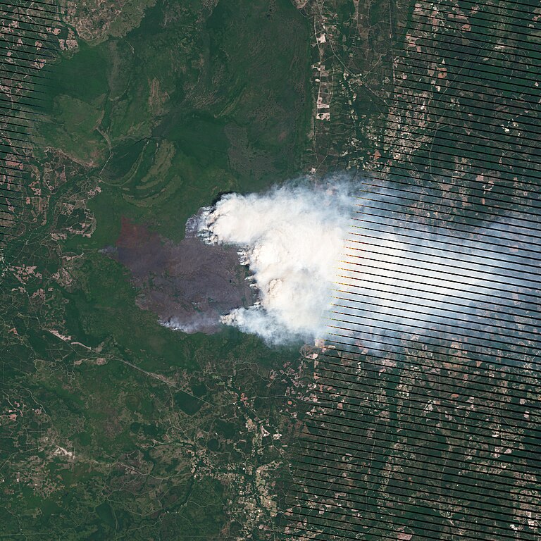
English: The Honey Prairie Fire in Georgia. |
| Date | |
| Source | NASA Earth Observatory |
| Author | Jesse Allen and Robert Simmon |
| Camera location |
| View this and other nearby images on: OpenStreetMap |
|
|---|
Image captured by the Landsat-7 satellite.
Licensing
| This file is in the public domain in the United States because it was solely created by NASA. NASA copyright policy states that "NASA material is not protected by copyright unless noted". (See Template:PD-USGov, NASA copyright policy page or JPL Image Use Policy.) | ||
 |
Warnings:
|
File history
Click on a date/time to view the file as it appeared at that time.
| Date/Time | Thumbnail | Dimensions | User | Comment | |
|---|---|---|---|---|---|
| current | 10:59, 12 May 2011 |
| 2,400 × 2,400 (3.01 MB) | Originalwana | {{Information |Description ={{en|1=The Honey Prairie Fire in Georgia.}} |Source =[http://earthobservatory.nasa.gov/IOTD/view.php?id=50531 NASA Earth Observatory] |Author =Jesse Allen and Robert Simmon |Date =2011-05-08 |Permis |
File usage
The following pages on the English Wikipedia use this file (pages on other projects are not listed):