
Size of this preview:
800 × 556 pixels. Other resolutions:
320 × 222 pixels |
640 × 444 pixels |
1,024 × 711 pixels |
1,280 × 889 pixels |
2,560 × 1,778 pixels |
6,161 × 4,279 pixels.
Original file (6,161 × 4,279 pixels, file size: 23.48 MB, MIME type: image/jpeg)
| This is a file from the
Wikimedia Commons. Information from its
description page there is shown below. Commons is a freely licensed media file repository. You can help. |
Summary
| Description |
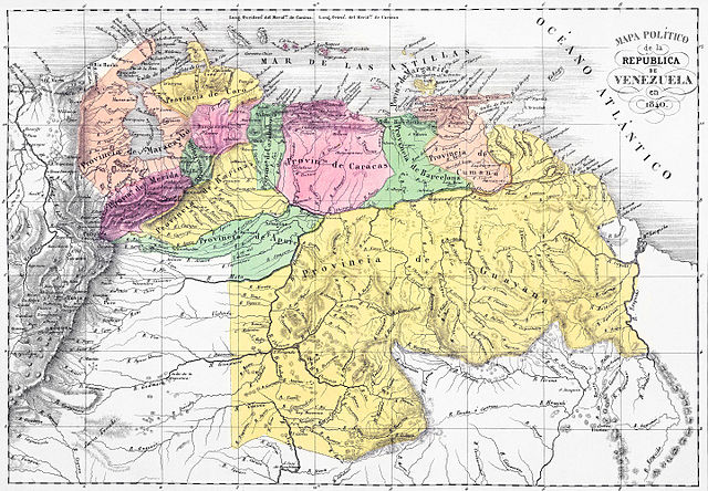
English: Political map of the Republic of Venezuela in 1840. Lith. de Thierry freres a Paris. (Caracas 1840). Size: 57x40cm. Two lithographed maps. Full hand col. Relief shown by hachures.
|
||||||||||||||||||||
| Date | |||||||||||||||||||||
| Source | Phillips, 2775. Phillips. Maps of America, p. 962. Catalogue of maps of Hispanic America, v. 3, p. 29. [1] | ||||||||||||||||||||
| Author |
|
||||||||||||||||||||
| Other versions |
|
||||||||||||||||||||


Licensing
|
This work is in the public domain in its country of origin and other countries and areas where the copyright term is the author's life plus 100 years or fewer. | |
| This file has been identified as being free of known restrictions under copyright law, including all related and neighboring rights. | |
File history
Click on a date/time to view the file as it appeared at that time.
| Date/Time | Thumbnail | Dimensions | User | Comment | |
|---|---|---|---|---|---|
| current | 18:44, 15 November 2015 |
| 6,161 × 4,279 (23.48 MB) | Wilfredor | restoring colors and paper |
| 16:36, 15 November 2015 |
 | 6,161 × 4,279 (24.93 MB) | Wilfredor | User created page with UploadWizard |
File usage
The following pages on the English Wikipedia use this file (pages on other projects are not listed):
Global file usage
The following other wikis use this file:
- Usage on ar.wikipedia.org
- Usage on ast.wikipedia.org
- Usage on ca.wikipedia.org
- Usage on de.wikisource.org
- Usage on es.wikipedia.org
- Usage on fr.wikipedia.org
- Usage on it.wikipedia.org
- Usage on pt.wikipedia.org
- Usage on ru.wikipedia.org
- Usage on sh.wikipedia.org
- Usage on uk.wikipedia.org
- Usage on www.wikidata.org