Size of this preview:
455 × 599 pixels. Other resolutions:
182 × 240 pixels |
364 × 480 pixels |
583 × 768 pixels |
777 × 1,024 pixels |
1,554 × 2,048 pixels |
5,910 × 7,786 pixels.
Original file (5,910 × 7,786 pixels, file size: 37.98 MB, MIME type: image/jpeg)
| This is a file from the
Wikimedia Commons. Information from its
description page there is shown below. Commons is a freely licensed media file repository. You can help. |
Summary
| Description |
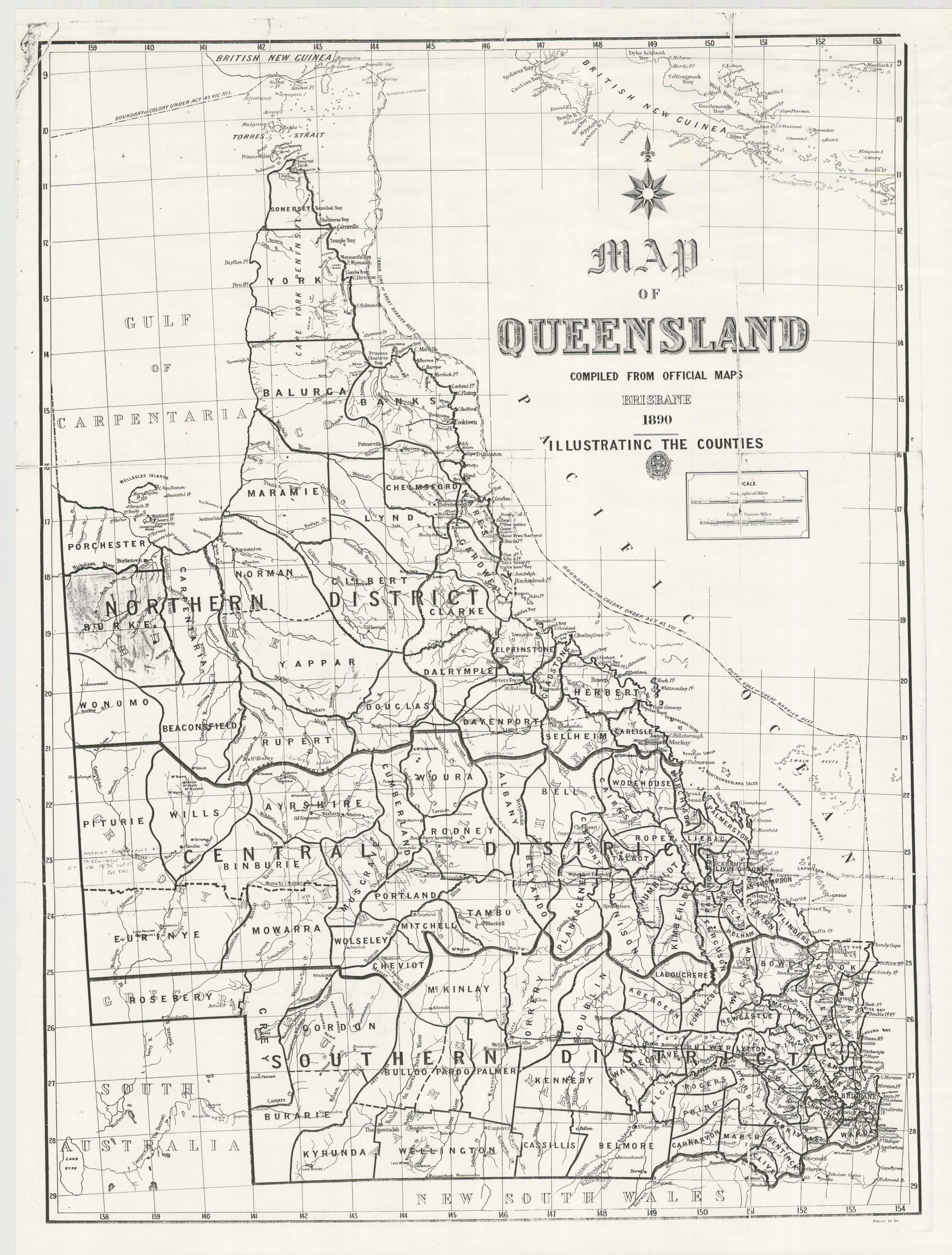
English: Map of the Queensland counties, 1890 |
| Date | |
| Source | Map of the Queensland counties. Queensland Government (1890). Retrieved on 22 February 2020. |
| Author | Unknown author |
Licensing
This image or other work is of
Australian origin and is now in the
public domain because its term of copyright has expired. According to the
Australian Copyright Council (ACC),
ACC Information Sheet G023v19 (Duration of copyright) (January 2019).1
When using this template, please provide information of where the image was first published and who created it. |
 | |||||||||||||||||||
File history
Click on a date/time to view the file as it appeared at that time.
| Date/Time | Thumbnail | Dimensions | User | Comment | |
|---|---|---|---|---|---|
| current | 01:31, 22 February 2020 |
| 5,910 × 7,786 (37.98 MB) | Kerry Raymond | User created page with UploadWizard |
File usage
The following pages on the English Wikipedia use this file (pages on other projects are not listed):