Size of this preview:
629 × 599 pixels. Other resolutions:
252 × 240 pixels |
504 × 480 pixels |
652 × 621 pixels.
Original file (652 × 621 pixels, file size: 67 KB, MIME type: image/jpeg)
Summary
| Description |
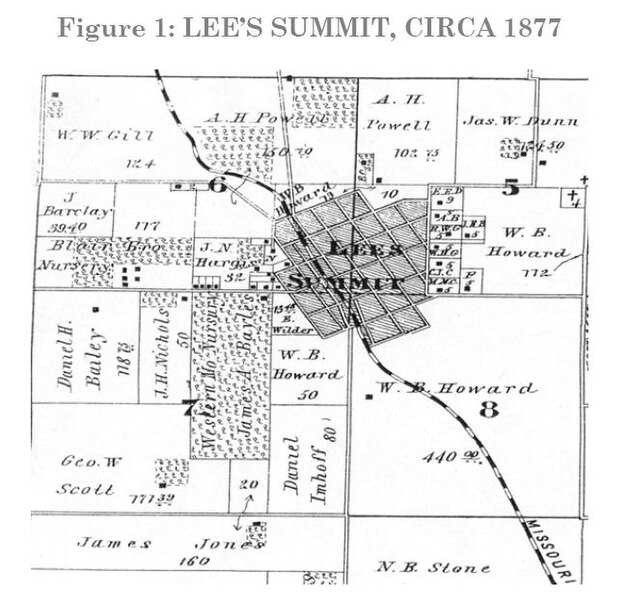
Map plat of Lee's Summit, Jackson County, Missouri, in 1877 | ||
|---|---|---|---|
| Source |
1877 Illustrated Historical Atlas of Jackson Co. Missouri | ||
| Date | |||
| Author |
| ||
| Permission ( Reusing this file) |
See below.
|
Licensing
| This image is in the public domain in the United States. In most cases, this means that it was first published prior to January 1, 1929 (see the template documentation for more cases). Other jurisdictions may have other rules, and this image might not be in the public domain outside the United States. See Wikipedia:Public domain and Wikipedia:Copyrights for more details. |
|
| This file is in the
public domain because its copyright has expired in the United States and those countries with a copyright term of no more than the life of the author plus 100 years.
|
 | This file is a candidate to be copied to
Wikimedia Commons.
Any user may perform this transfer; refer to Wikipedia:Moving files to Commons for details. If this file has problems with attribution, copyright, or is otherwise ineligible for Commons, then remove this tag and DO NOT transfer it; repeat violators may be blocked from editing. Other Instructions
| ||
| |||
File history
Click on a date/time to view the file as it appeared at that time.
| Date/Time | Thumbnail | Dimensions | User | Comment | |
|---|---|---|---|---|---|
| current | 11:40, 7 July 2008 |
 | 652 × 621 (67 KB) | Best O Fortuna ( talk | contribs) | {{Non-free use rationale |Article=Lee's Summit, circa 1877 (via Historic Preservation Plan: City of Lee’s Summit, Missouri) |Description=Map plat of Lee's Summit, Jackson County, Missouri, in 1877 |Source=1877 Illustrated Historical Atlas of Jackson Co. |
You cannot overwrite this file.
File usage
The following pages on the English Wikipedia use this file (pages on other projects are not listed):