Photos • Location


Size of this preview:
800 × 600 pixels. Other resolutions:
320 × 240 pixels |
640 × 480 pixels |
1,024 × 768 pixels |
1,280 × 960 pixels |
2,560 × 1,920 pixels |
3,264 × 2,448 pixels.
Original file (3,264 × 2,448 pixels, file size: 3.27 MB, MIME type: image/jpeg)
| This is a file from the
Wikimedia Commons. Information from its
description page there is shown below. Commons is a freely licensed media file repository. You can help. |
Summary
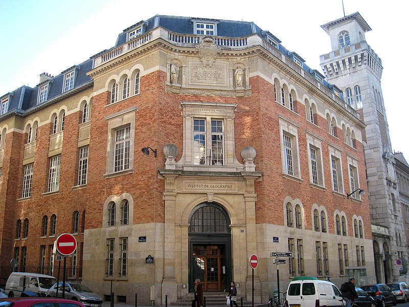
| Description | Institut de Géographie, Sorbonne Paris IV, 191, Rue Saint-Jacques, Paris, France - exterior view. Architect: Henri Paul Nénot. |
| Date | |
| Source | Self-photographed |
| Author | Daderot |
| Permission ( Reusing this file) |
Own work, all rights released (Public domain) |
| Camera location | | View this and other nearby images on: OpenStreetMap |
|
|---|
Licensing
| I, the copyright holder of this work, release this work into the
public domain. This applies worldwide. In some countries this may not be legally possible; if so: I grant anyone the right to use this work for any purpose, without any conditions, unless such conditions are required by law. |
File history
Click on a date/time to view the file as it appeared at that time.
| Date/Time | Thumbnail | Dimensions | User | Comment | |
|---|---|---|---|---|---|
| current | 16:12, 23 February 2008 |
| 3,264 × 2,448 (3.27 MB) | Daderot | {{Information |Description=Institut de Géographie, Sorbonne Paris IV, 191, Rue Saint-Jacques, Paris, France - exterior view. |Source=I took this photograph. |Date=February 9, 2008. |Author= Daderot |Permission=Own work, all rights release |
File usage
The following pages on the English Wikipedia use this file (pages on other projects are not listed):
Global file usage
The following other wikis use this file:
- Usage on de.wikipedia.org
- Usage on fr.wikipedia.org
- Usage on id.wikipedia.org
- Usage on ko.wikipedia.org
- Usage on zh.wikipedia.org