Photos • Location


Size of this preview:
800 × 600 pixels. Other resolutions:
320 × 240 pixels |
640 × 480 pixels |
1,024 × 768 pixels |
1,280 × 960 pixels |
1,600 × 1,200 pixels.
Original file (1,600 × 1,200 pixels, file size: 442 KB, MIME type: image/jpeg)
| This is a file from the
Wikimedia Commons. Information from its
description page there is shown below. Commons is a freely licensed media file repository. You can help. |
,_Yorkshire_(geograph_6625023).jpg)
Summary
| Description |
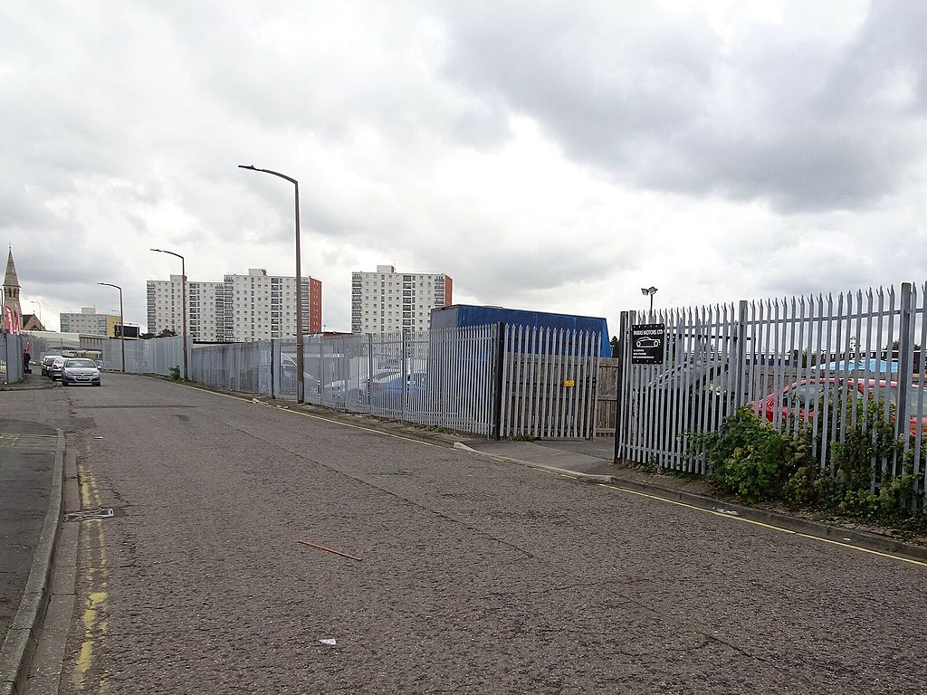
English: Doncaster Cherry Tree station (site), Yorkshire Opened as "Cherry Tree Lane" in 1849 by the South Yorkshire Railway as the terminus of its line from Swinton, this station quickly became just "Cherry Tree" and closed to passengers in 1852 when trains were extended to the current Doncaster station. It remained open as "Cherrytree" goods station into the 1960s. View north east towards central Doncaster. The station was to the right of the road, behind the current fencing. Further to the right but out of shot is the Swinton-Doncaster railway line. |
| Date | |
| Source | From geograph.org.uk |
| Author | Nigel Thompson |
| Permission ( Reusing this file) |
Creative Commons Attribution Share-alike license 2.0 |
| Attribution ( required by the license) | Nigel Thompson / Doncaster Cherry Tree station (site), Yorkshire / |
| Camera location | | View this and other nearby images on: OpenStreetMap |
|
|---|
,_Yorkshire_(geograph_6625023).jpg¶ms=053.516828_N_-001.143799_E_globe:Earth_type:camera_source:geograph-osgb36(SE56870258)_heading:67.00&language=en)
| Object location | | View this and other nearby images on: OpenStreetMap |
|
|---|
,_Yorkshire_(geograph_6625023).jpg¶ms=053.517000_N_-001.142290_E_globe:Earth_class:object_type:object_source:geograph-osgb36(SE56970260)_heading:67.00&language=en)
Licensing

|
This image was taken from the
Geograph project collection. See
this photograph's page on the Geograph website for the photographer's contact details. The copyright on this image is owned by Nigel Thompson and is licensed for reuse under the
Creative Commons Attribution-ShareAlike 2.0 license.
|
This file is licensed under the
Creative Commons
Attribution-Share Alike 2.0 Generic license.
Attribution: Nigel Thompson
- You are free:
- to share – to copy, distribute and transmit the work
- to remix – to adapt the work
- Under the following conditions:
- attribution – You must give appropriate credit, provide a link to the license, and indicate if changes were made. You may do so in any reasonable manner, but not in any way that suggests the licensor endorses you or your use.
- share alike – If you remix, transform, or build upon the material, you must distribute your contributions under the same or compatible license as the original.
File history
Click on a date/time to view the file as it appeared at that time.
| Date/Time | Thumbnail | Dimensions | User | Comment | |
|---|---|---|---|---|---|
| current | 18:35, 5 October 2020 |
| 1,600 × 1,200 (442 KB) | Lamberhurst | Transferred from geograph.co.uk using [https://tools.wmflabs.org/geograph2commons/ geograph2commons] |
File usage
The following pages on the English Wikipedia use this file (pages on other projects are not listed):
,_Yorkshire_(geograph_6625023).jpg)