
Size of this preview:
800 × 553 pixels. Other resolutions:
320 × 221 pixels |
640 × 443 pixels |
1,024 × 708 pixels |
1,280 × 885 pixels |
2,560 × 1,770 pixels |
4,000 × 2,766 pixels.
Original file (4,000 × 2,766 pixels, file size: 1.48 MB, MIME type: image/jpeg)
| This is a file from the
Wikimedia Commons. Information from its
description page there is shown below. Commons is a freely licensed media file repository. You can help. |
.jpg)
Summary
| Description |
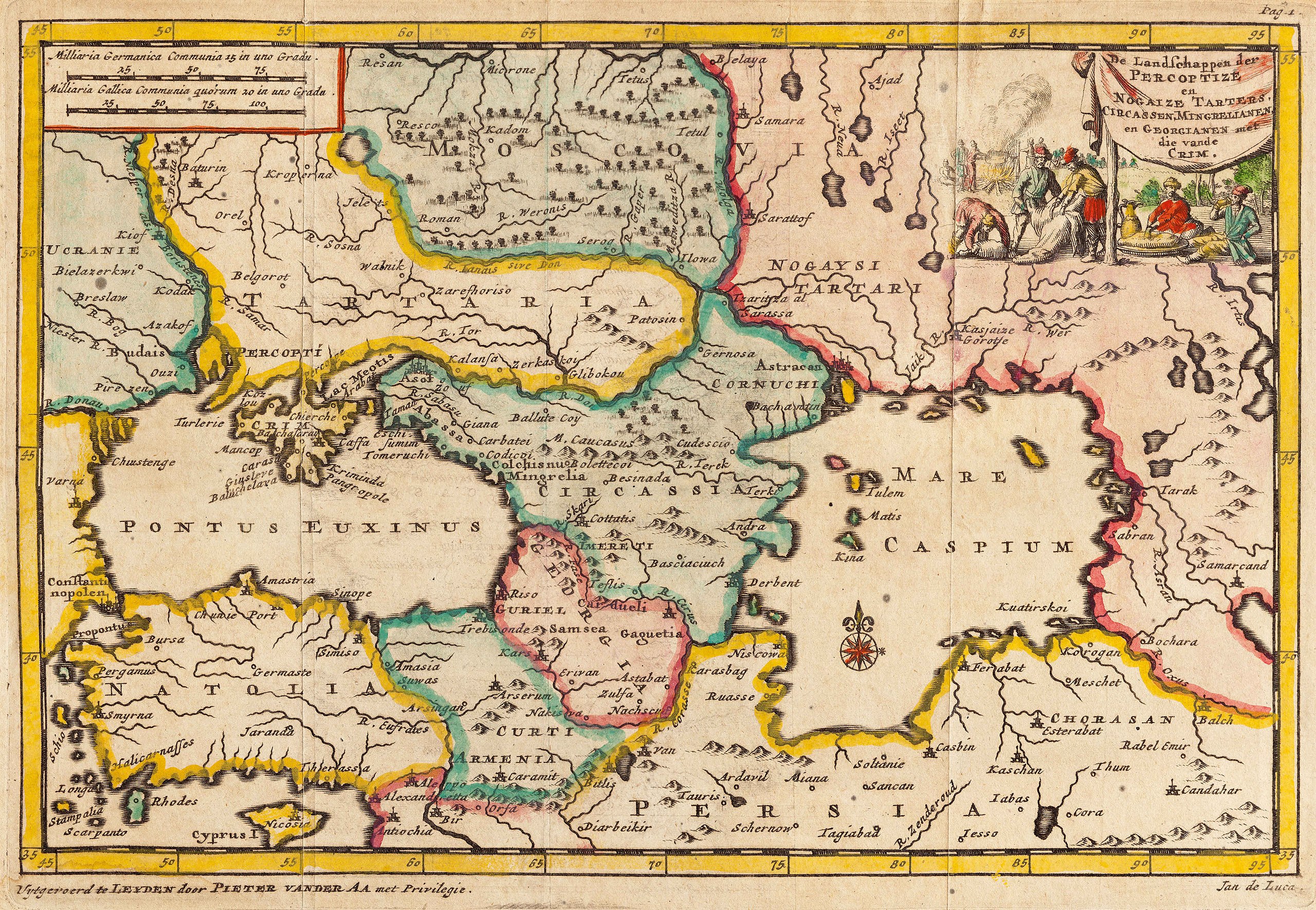
Українська: De Landschappen der Percoptize en Nogaize Tartares, Circassen, P Van der Aa (Leiden, 1707)
Карта Пітера Ван дер Аа [Piter Van der Aa] 1707 р. Виконана у популярній тогочасній проекції, коли на одному аркуші вміщували територію від Чорного до Каспійського моря. Карта вирізняється картушем із зображенням побутової сцени життя ногайських татар. Чітко окреслені політичні кордони України, що проходять по лінії течії Дніпра. https://uk.wikipedia.org/?title=VkrainaРусский: De Landschappen der Percoptize en Nogaize Tartares, Circassen, P Van der Aa (Leiden, 1707), карта Крымского ханства (Малая Тартария в европейской картографии) в 1707 году |
| Date | |
| Source | De Landschappen der Percoptize en Nogaize Tartares |
| Author | Piter Van der Aa |
Licensing
I, the copyright holder of this work, hereby publish it under the following license:
This file is licensed under the
Creative Commons
Attribution-Share Alike 3.0 Unported license.
- You are free:
- to share – to copy, distribute and transmit the work
- to remix – to adapt the work
- Under the following conditions:
- attribution – You must give appropriate credit, provide a link to the license, and indicate if changes were made. You may do so in any reasonable manner, but not in any way that suggests the licensor endorses you or your use.
- share alike – If you remix, transform, or build upon the material, you must distribute your contributions under the same or compatible license as the original.
File history
Click on a date/time to view the file as it appeared at that time.
| Date/Time | Thumbnail | Dimensions | User | Comment | |
|---|---|---|---|---|---|
| current | 05:44, 24 September 2021 |
| 4,000 × 2,766 (1.48 MB) | Lanamy | Higher resolution |
| 15:00, 28 May 2014 |
 | 2,500 × 1,729 (2.15 MB) | VLebid | User created page with UploadWizard |
File usage
The following pages on the English Wikipedia use this file (pages on other projects are not listed):
Global file usage
The following other wikis use this file:
- Usage on ast.wikipedia.org
- Usage on bn.wikipedia.org
- Usage on ca.wikipedia.org
- Usage on crh.wikipedia.org
- Usage on et.wikipedia.org
- Usage on fiu-vro.wikipedia.org
- Usage on ga.wikipedia.org
- Usage on gl.wikipedia.org
- Usage on hy.wikipedia.org
- Usage on la.wikipedia.org
- Usage on pl.wikipedia.org
- Usage on ru.wikipedia.org
- Usage on tg.wikipedia.org
- Usage on uk.wikipedia.org
- Usage on vi.wikipedia.org
- Usage on www.wikidata.org
- Usage on zh.wikipedia.org
.jpg)