
Size of this preview:
800 × 548 pixels. Other resolutions:
320 × 219 pixels |
640 × 439 pixels |
1,024 × 702 pixels.
Original file (1,024 × 702 pixels, file size: 125 KB, MIME type: image/jpeg)
| This is a file from the
Wikimedia Commons. Information from its
description page there is shown below. Commons is a freely licensed media file repository. You can help. |
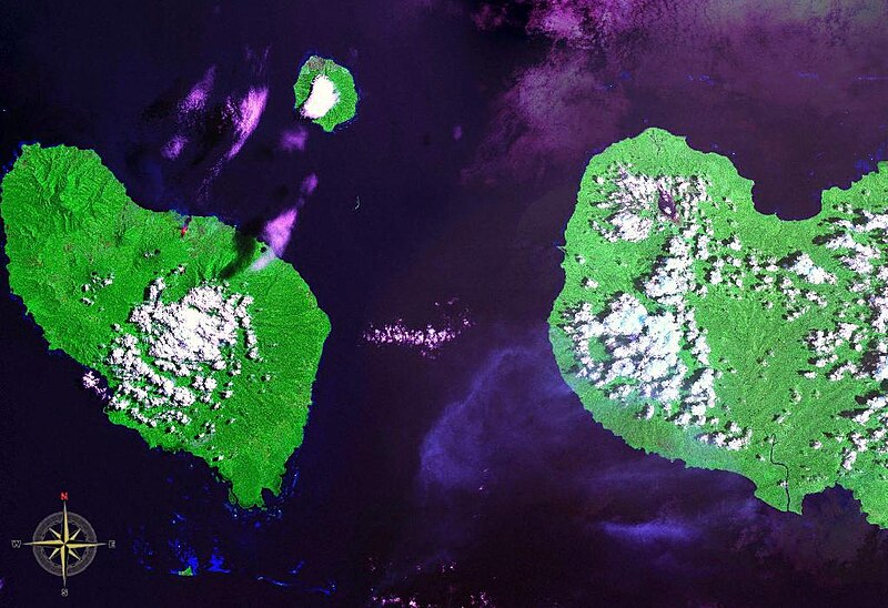
Dampier Strait in Papua New Guinea. Also visible are: Umboi Island (west), New Britain (east) and Sakar Island (north).
| This image is in the
public domain because it is a screenshot from
NASA’s globe software
World Wind using a public domain layer, such as Blue Marble, MODIS, Landsat, SRTM, USGS or GLOBE.
|
 |
File history
Click on a date/time to view the file as it appeared at that time.
| Date/Time | Thumbnail | Dimensions | User | Comment | |
|---|---|---|---|---|---|
| current | 10:22, 8 August 2006 |
| 1,024 × 702 (125 KB) | Darwinek | Dampier Strait in Papua New Guinea. Also visible are: Umboi Island (west), New Britain (east) and Sakar Island (north. {{PD-WorldWind}} Category:Papua New Guinea Category:Straits |
File usage
The following pages on the English Wikipedia use this file (pages on other projects are not listed):
Global file usage
The following other wikis use this file:
- Usage on arz.wikipedia.org
- Usage on ast.wikipedia.org
- Usage on az.wikipedia.org
- Usage on ceb.wikipedia.org
- Usage on de.wikipedia.org
- Usage on es.wikipedia.org
- Usage on fi.wikipedia.org
- Usage on fr.wikipedia.org
- Usage on fr.wiktionary.org
- Usage on he.wikipedia.org
- Usage on hy.wikipedia.org
- Usage on it.wikipedia.org
- Usage on ja.wikipedia.org
- Usage on ka.wikipedia.org
- Usage on pl.wikipedia.org
- Usage on pnb.wikipedia.org
- Usage on pt.wikipedia.org
- Usage on ru.wikipedia.org
- Usage on sv.wikipedia.org
- Usage on vi.wikipedia.org
- Usage on www.wikidata.org
- Usage on zh.wikipedia.org