
Size of this preview:
526 × 599 pixels. Other resolutions:
211 × 240 pixels |
421 × 480 pixels |
674 × 768 pixels |
899 × 1,024 pixels |
2,100 × 2,392 pixels.
Original file (2,100 × 2,392 pixels, file size: 2.75 MB, MIME type: image/jpeg)
| This is a file from the
Wikimedia Commons. Information from its
description page there is shown below. Commons is a freely licensed media file repository. You can help. |
| Description |
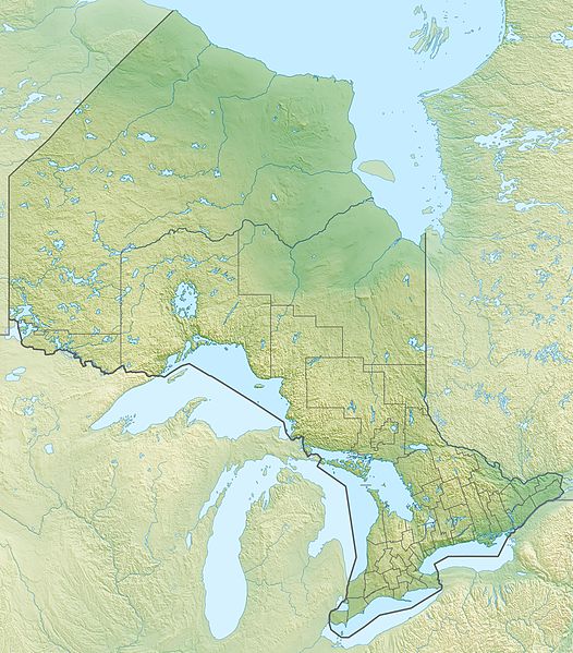
Quadratische Plattkarte, N-S-Streckung 155 %. Geographische Begrenzung der Karte:
Equirectangular projection, N/S stretching 155 %. Geographic limits of the map:
|
| Date | |
| Source |
Own work, using
|
| Author | Carport |
| Permission ( Reusing this file) |
This file is licensed under the
Creative Commons
Attribution-Share Alike 3.0 Unported license.
|
| Other versions |
|


File history
Click on a date/time to view the file as it appeared at that time.
| Date/Time | Thumbnail | Dimensions | User | Comment | |
|---|---|---|---|---|---|
| current | 19:04, 30 November 2012 |
| 2,100 × 2,392 (2.75 MB) | Carport | {{Information |Description= {{de|Physische Positionskarte von Ontario, Kanada}} Quadratische Plattkarte, N-S-Streckung 155 %. Geographische Begrenzung der Karte: * N: 57.1° N * S: 41.3° N * W: 95.5° W * O: 74.0° W {{e... |
File usage
More than 100 pages use this file. The following list shows the first 100 pages that use this file only. A full list is available.
- Abitibi River
- Agawa Canyon
- Agawa River
- Aguasabon River
- Albany River
- Ausable River (Lake Huron)
- Batchawana River
- Battle of Chippawa
- Battle of Crysler's Farm
- Battle of the Thames
- Black Sturgeon River (Thunder Bay District)
- Blind River (Ontario)
- Brightsand River
- Budweiser Gardens
- CAA Arena
- Canadian Open (golf)
- Cedar Lake (Nipissing District)
- Central Canada
- Chemong Lake
- Christie Pits
- Coca-Cola Coliseum
- Cook's Bay (Ontario)
- Credit River
- Current River (Ontario)
- English River (Ontario)
- Fawn River (Ontario)
- FirstOntario Centre
- French River (Ontario)
- Georgian Bay
- Go Home River
- Goulais River
- Indian River (Muskrat River watershed)
- Ishpatina Ridge
- James Bay
- Kaibuskong River
- Kakabeka Falls
- Kaministiquia River
- Kawartha Highlands Provincial Park
- Kawaweogama Lake
- Kenogami River
- Kitchener Memorial Auditorium Complex
- Lake Abitibi
- Lake Doré
- Lake Manitou
- Lake Nipigon
- Lake Nipissing
- Lake Ontario
- Lake Saint Francis (Canada)
- Lake Temagami
- Lake Timiskaming
- Lake Wanapitei
- Lake of the Woods
- List of airports in the Greater Toronto Area
- List of airports in the Ottawa area
- List of lakes of Ontario
- London, Ontario
- Magpie River (Ontario)
- Maple Leaf Gardens
- Mattagami River
- Mazinaw Lake
- Mississagi Provincial Park
- Mississagi River
- Moose River (Ontario)
- Murdock River
- Muskrat River (Ontario)
- Ogoki River
- Old Man's Lake
- Old Woman River (Ontario)
- Ouimet Canyon
- Paramount Fine Foods Centre
- Petawawa River
- Peterborough Memorial Centre
- Pic River
- Pierre Gaultier de Varennes, sieur de La Vérendrye
- Pigeon River (Minnesota–Ontario)
- Progressive Auto Sales Arena
- Red Cedar Lake (Ontario)
- Restoule River
- River aux Sables
- Rob Ford Stadium
- Sadlon Arena
- Sand River (Ontario)
- Scotiabank Arena
- Seguin River
- Seine River (Ontario)
- Shoal Lake (Kenora District, Ontario)
- Skeleton Lake (Ontario)
- Sleeman Centre (Guelph)
- Spanish River (Ontario)
- Steel River (Ontario)
- Sturgeon Lake (Ontario)
- Sturgeon River (Lake Nipissing)
- Sudbury Community Arena
- TD Place Stadium
- Toronto Harbour
- Varsity Arena
- Varsity Stadium
- Wabakimi Provincial Park
- Wabigoon Lake
- Wabigoon River
View more links to this file.
Global file usage
The following other wikis use this file:
- Usage on ar.wikipedia.org
- Usage on ast.wikipedia.org
- Usage on az.wikipedia.org
- Usage on ban.wikipedia.org
- Usage on be-tarask.wikipedia.org
- Usage on be.wikipedia.org
- Usage on bg.wikipedia.org
- Отава
- Торонто
- Капъскейсинг
- Мисисага
- Гуелф
- Хамилтън (Онтарио)
- Бари (Канада)
- Кингстън (Канада)
- Брамптън
- Маркъм
- Вон (Канада)
- Шаблон:ПК Канада Онтарио
- Тъндърбей
- Лондон (Онтарио)
- Брантфорд
- Сарния (Онтарио)
- Уиндзър (Онтарио)
- Северен Хюрън
- Оуквил
- Френч Ривър
- Джорджиан Бей
- Ренфру (Канада)
- Университет на Торонто
- Манитулин
- Джеймс (залив)
- Барис Бей
- Usage on bn.wikipedia.org
- Usage on ce.wikipedia.org
- Usage on de.wikipedia.org
View more global usage of this file.