
Size of this preview:
485 × 600 pixels. Other resolutions:
194 × 240 pixels |
616 × 762 pixels.
Original file (616 × 762 pixels, file size: 33 KB, MIME type: image/png)
| This is a file from the
Wikimedia Commons. Information from its
description page there is shown below. Commons is a freely licensed media file repository. You can help. |
Summary
| Description |
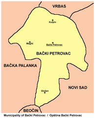
English: Map of Bački Petrovac municipality, Vojvodina, Serbia
Српски / srpski: мапа општине Бачки Петровац, Војводина, Србија |
| Date | |
| Source | Own work, moved to commons from: http://en.wikipedia.org/wiki/Image:Backi_petrovac.png |
| Author | PANONIAN |
Licensing
| This work has been released into the
public domain by its author,
PANONIAN. This applies worldwide. In some countries this may not be legally possible; if so: |
References
- Geografski atlas, Magic Map, Smederevska Palanka, 2001.
- Geografski atlas, Intersistem Kartografija, Beograd, 2004.
- Denis Šehić - Demir Šehić, Geografski atlas Srbije, Beograd, 2007.
- Dr Slobodan Ćurčić, Naselja Bačke - geografske karakteristike, Novi Sad, 2007.
- http://vajdasag.rs/images/0/02/Vajdaság_autóstérképe.png archive copy at the Wayback Machine
- http://www.lokalnirazvoj.org/upload/Book/Image/2012_03/Vojvodina_Region.jpg
- http://www.skupstinavojvodine.gov.rs/Slike/opstine.gif archive copy at the Wayback Machine
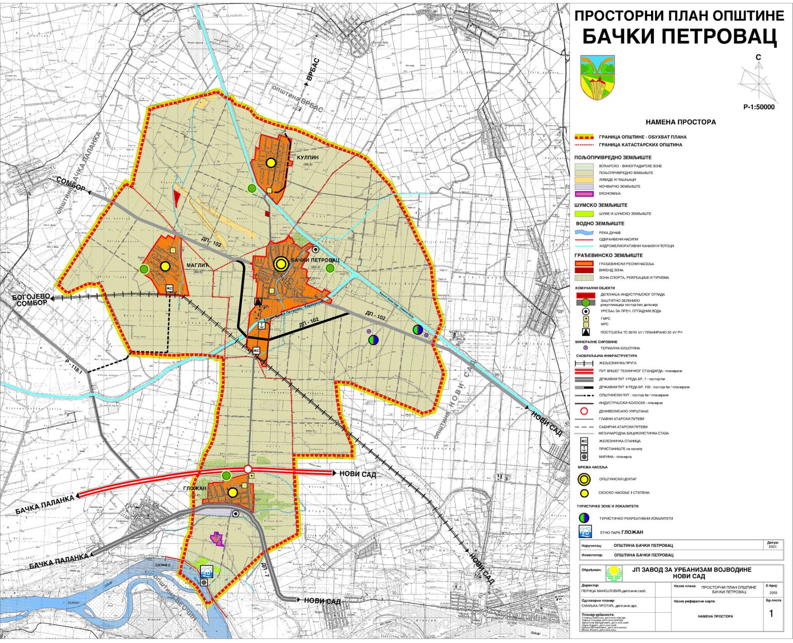
- http://www.zavurbvo.co.rs/images/planovi/backi_petrovac.jpg
- http://www.backipetrovac.rs/kartaopstine_big.jpg
- http://www.turizambackipetrovac.com/Images/mapa.gif archive copy at the Wayback Machine
File history
Click on a date/time to view the file as it appeared at that time.
| Date/Time | Thumbnail | Dimensions | User | Comment | |
|---|---|---|---|---|---|
| current | 21:42, 16 February 2013 |
| 616 × 762 (33 KB) | PANONIAN | improved version |
| 16:07, 16 February 2009 |
 | 450 × 576 (12 KB) | PANONIAN | ||
| 11:47, 31 January 2007 |
 | 450 × 576 (9 KB) | Kelovy | == Opis súboru == {{Information |Description=Map of Backi Petrovac municipality |Source=http://en.wikipedia.org/wiki/Image:Backi_petrovac.png |Date= |Author= en:User:PANONIAN |Permission=free |other_versions=not }} [[Category:Maps of Vojvodina munici |
File usage
The following pages on the English Wikipedia use this file (pages on other projects are not listed):
Global file usage
The following other wikis use this file:
- Usage on cs.wikipedia.org
- Usage on es.wikipedia.org
- Usage on fa.wikipedia.org
- Usage on fr.wikipedia.org
- Usage on hr.wikipedia.org
- Usage on hu.wikipedia.org
- Usage on ru.wikipedia.org
- Usage on sh.wikipedia.org
- Usage on sq.wikipedia.org
- Usage on sr.wikipedia.org
- Usage on tt.wikipedia.org
- Usage on uk.wikipedia.org
- Usage on www.wikidata.org