Photos • Location


Size of this preview:
600 × 599 pixels. Other resolutions:
240 × 240 pixels |
481 × 480 pixels |
905 × 904 pixels.
Original file (905 × 904 pixels, file size: 933 KB, MIME type: image/jpeg)
| This is a file from the
Wikimedia Commons. Information from its
description page there is shown below. Commons is a freely licensed media file repository. You can help. |
Summary
| Description |
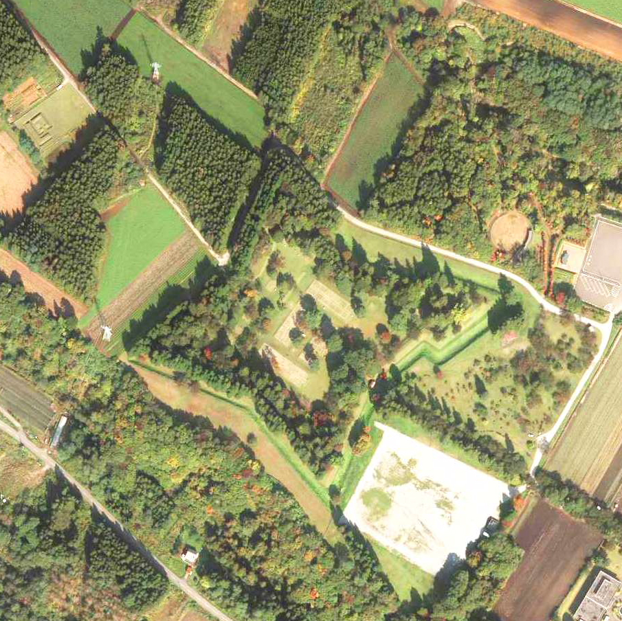
北海道北斗市戸切地陣屋跡上空の空中写真。 国土交通省撮影の空中写真CHO20116-C9A-8を使用。 |
| Date | |
| Source | 国土地理院地図・空中写真閲覧サービス |
| Author | 国土交通省国土地理院 |
| Camera location |
| View this and other nearby images on: OpenStreetMap |
|
|---|
Licensing

|
The copyright holder of this file, the Ministry of Land, Infrastructure, Transport and Tourism of Japan, allows anyone to use it for any purpose, provided that the copyright holder is properly attributed. Redistribution, derivative work, commercial use, and all other use is permitted. |
Attribution:
Copyright ©
National Land Image Information (Color Aerial Photographs), Ministry of Land, Infrastructure, Transport and Tourism
|
 |
This image is copyrighted by
the Ministry of Land, Infrastructure, Transport and Tourism of Japan. For terms of use, see
the stipulation to use of National Land Information (in Japanese) and
message from MLIT (in Japanese and English). When you display this image on an article, include the following phrase in the description: "Made based on
National Land Image Information (Color Aerial Photographs), Ministry of Land, Infrastructure, Transport and Tourism".
|
File history
Click on a date/time to view the file as it appeared at that time.
| Date/Time | Thumbnail | Dimensions | User | Comment | |
|---|---|---|---|---|---|
| current | 05:48, 18 December 2021 |
| 905 × 904 (933 KB) | 名古屋太郎 | {{Information |Description= 北海道北斗市戸切地陣屋跡上空の空中写真。 国土交通省撮影の空中写真CHO20116-C9A-8を使用。 |Source= 国土地理院地図・空中写真閲覧サービス |Date= 2011-10-14 |Author= 国土交通省国土地理院 |Permission= |other_versions= }} Category:History of Hokkaido Category:Taken with Vexcel UltraCam D |
File usage
The following pages on the English Wikipedia use this file (pages on other projects are not listed):
Global file usage
The following other wikis use this file: