Photos • Location
| Emu Bay | |
|---|---|
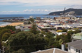
 Emu Bay in the distance, with
Burne Port in the foreground. | |
Location in
Tasmania | |
| Location | North West Tasmania |
| Coordinates | 41°03′49″S 145°52′31″E / 41.06361°S 145.87528°E |
| Type | Embayment |
| River sources | Emu River |
| Primary outflows | Bass Strait |
| Settlements | Burnie |
Emu Bay is a bay on the north-western coast of Tasmania, Australia.
The bay is fed by the Emu River and empties into Bass Strait. [1] The bay is adjacent to the city of Burnie, Tasmania, which was also originally named Emu Bay but later renamed for William Burnie a director of the Van Diemen's Land Company in the early 1840s.
See also
References
- ^ "Map of Blythe River, TAS". Bonzle Digital Atlas of Australia. 2015. Retrieved 30 June 2015.
