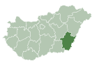
Photos • Location

Dévaványa | |
|---|---|
 The northern side of the main street in Dévaványa | |
| Coordinates: 47°01′48″N 20°57′32″E / 47.030°N 20.959°E | |
| Country | |
| County | Békés |
| District | Gyomaendrőd |
| Government | |
| • Mayor | Valánszki Miklós Róbert ( Ind.) |
| Area | |
| • Total | 216.65 km2 (83.65 sq mi) |
| Population (2024)
[3] | |
| • Total | 6,793 |
| • Density | 31/km2 (81/sq mi) |
| Time zone | UTC+1 ( CET) |
| • Summer ( DST) | UTC+2 ( CEST) |
| Postal code | 5510 |
| Area code | (+36) 66 |
| Website |
www |
Dévaványa is a town in northern Békés county, in the Southern Great Plain region of Hungary.
Geography
It covers an area of 216.65 km² [2] and has a population of 6,793 people (2024). [3]
History
The town first appeared in writing in the 1330s, first under the name "Jana" and then under the name "Vana". In 1523, Louis II of Hungary elevated the town's status to that of a market town. In 1523, the town can first be spotted on maps of Hungary under the name "Wama". In 1693, an army of Tatars decimated the town, causing the majority of its inhabitants to flee to the town of Tiszabábolna in Borsod County.
Twin towns – sister cities
Dévaványa is twinned with:
-
 Cristuru Secuiesc, Romania
[4] (1994)
References
- ^ "Település adatlap". Nemzeti Választási Iroda (in Hungarian). Retrieved 1 May 2024.
- ^ a b "Detailed Gazetteer of Hungary". www.ksh.hu. Retrieved 1 May 2024.
- ^ a b "Census 2022". Census 2022. Retrieved 1 May 2024.
- ^ "Testvérvárosaink". keresztur.ro (in Hungarian).
External links
Wikimedia Commons has media related to
Dévaványa.
- Official website in Hungarian
47°02′N 20°58′E / 47.033°N 20.967°E


