Photos • Location
Castillejo de Iniesta | |
|---|---|
 | |
| Coordinates: 39°32′N 1°46′W / 39.533°N 1.767°W | |
| Country | |
| Autonomous community | |
| Province | Cuenca |
| Comarca | Manchuela conquense |
| Government | |
| • Alcalde | Enrique Lucas Mateo (2007) ( PSOE) |
| Area | |
| • Total | 27.70 km2 (10.70 sq mi) |
| Elevation | 824 m (2,703 ft) |
| Population (2018)
[1] | |
| • Total | 150 |
| • Density | 5.4/km2 (14/sq mi) |
| Demonym(s) | Castillejero, castillejera |
| Time zone | UTC+1 ( CET) |
| • Summer ( DST) | UTC+2 ( CEST) |
| Postal code | 16250 |
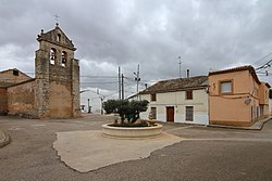
Castillejo de Iniesta is a municipality in Cuenca, Castile-La Mancha, Spain. It just west of Graja de Iniesta.
In recent years, there has been a movement to remove the Iniesta element in the name of the town.[ citation needed]
References
- ^ Municipal Register of Spain 2018. National Statistics Institute.


