Photos • Location


Villa Cameron | |
|---|---|
| Coordinates: 53°38′16″S 69°38′52″W / 53.63778°S 69.64778°W | |
| Country | Chile |
| Region | Magallanes |
| Province | Tierra del Fuego |
| Municipality | Timaukel |
| Commune | Timaukel |
| Government | |
| • Mayor | Alfonso Simunovic |
| Population (2002 census
[1]) | |
| • Total | 62 |
| Time zone | UTC−04:00 (Chilean Standard) |
| • Summer ( DST) | UTC−03:00 (Chilean Daylight) |
| Area code | Country + town = 56 + ? |
| Climate | Cfc |

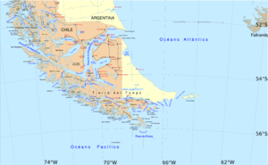
Location of Villa Cameron in the Magallanes Region.
Villa Cameron is a hamlet ( Spanish: aldea) in southern Tierra del Fuego Island, and is the head of Timaukel commune, in Magallanes Region. [1] Villa Cameron is located in the southern shore of Inútil Bay. The city is served by the Pampa Guanaco Airport ( IATA: DPB, ICAO: SCBI).
References
- ^ http://www.municipalidadtimaukel.cl Website of the Municipality of Timaukel