Photos • Location
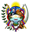
Cajigal Municipality
Municipio Cajigal | |
|---|---|
 Location in
Sucre | |
| Coordinates: 10°34′11″N 62°49′45″W / 10.5697°N 62.8292°W | |
| Country | |
| State | Sucre |
| Area | |
| • Total | 365 km2 (141 sq mi) |
| Time zone | UTC−4 ( VET) |
| Website | Official website |
Cajigal is a municipality of Sucre, Venezuela. The capital is Yaguaraparo. As of 2015, Cajigal had a population of 25,225. [1] [2]
References
- ^ "Cajigal - Population - CityFacts". www.city-facts.com. Retrieved 2021-05-20.
- ^ "+Bioline International Official Site (site up-dated regularly)". www.bioline.org.br. Retrieved 2021-05-20.


