Photos • Location
| Braigh nan Uamhachan | |
|---|---|
 Braigh nan Uamhachan | |
| Highest point | |
| Elevation | 765 m (2,510 ft) [1] |
| Prominence | 276 m (906 ft) |
| Listing | Corbett, Marilyn |
| Geography | |
| Location | Lochaber, Scotland |
| Parent range | Northwest Highlands |
| OS grid | NM975867 |
| Topo map | OS Landranger 40 |
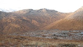
Braigh nan Uamhachan (765 m) is a mountain in the Northwest Highlands of Scotland. It is located north of Glenfinnan in Lochaber.
Taking the form of a long ridge, the climb is steep and pathless, but provides fantastic views of all the neighbouring peaks from its summit. [2]
References
- ^ "Braigh nan Uamhachan". hill-bagging.co.uk. Retrieved 16 June 2019.
- ^ "walkhighlands Braigh nan Uamhachan". walkhighlands.co.uk. Retrieved 16 June 2019.
56°55′37″N 5°19′48″W / 56.927°N 5.330°W