Photos • Location
| Bondend | |
|---|---|
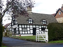
 Bondend Farm | |
Location within
Gloucestershire | |
| OS grid reference | SO8615 |
| District | |
| Shire county | |
| Region | |
| Country | England |
| Sovereign state | United Kingdom |
| Police | Gloucestershire |
| Fire | Gloucestershire |
| Ambulance | South Western |
Bondend is a lane within the village of Upton St Leonards in Gloucestershire, England.
External links
![]() Media related to
Bondend at Wikimedia Commons
Media related to
Bondend at Wikimedia Commons
