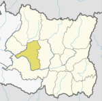
Photos • Location
Bijaya Kharka
विजयखर्क | |
|---|---|
| Country | |
| Zone | Sagarmatha Zone |
| District | Khotang District |
| Population (1991) | |
| • Total | 2,590 |
| Time zone | UTC+5:45 ( Nepal Time) |
Bijaya Kharka is a village and Village Development Committee in Khotang District in the Sagarmatha Zone of eastern Nepal. At the time of the 1991 Nepal census it had a population of 2,590 persons living in 493 individual households. [1]
References
- ^ "Nepal Census 2001". Nepal's Village Development Committees. Digital Himalaya. Archived from the original on 12 October 2008. Retrieved 30 September 2008.
External links
28°13′06″N 83°39′57″E / 28.21833°N 83.66583°E
