Photos • Location
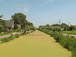
Benedenkerk, vliet in the ¨polder

Benedenkerk | |
|---|---|
Hamlet | |
 | |
 The village (dark green) and the statistical district (light green) of Benedenkerk in the former municipality of Vlist. | |
| Coordinates: 51°57′56″N 4°45′15″E / 51.96556°N 4.75417°E | |
| Country | Netherlands |
| Province | South Holland |
| Municipality | Krimpenerwaard |
| Time zone | UTC+1 ( CET) |
| • Summer ( DST) | UTC+2 ( CEST) |
Benedenkerk is a town in the Dutch province of South Holland. It is a part of the municipality of Krimpenerwaard, and lies about 6 km south of Gouda.
The statistical area "Benedenkerk", which also can include the surrounding countryside, has a population of around 260. [1]
Until 2015, Benedenkerk was part of Vlist.
- ^ Statistics Netherlands (CBS), Statline: Kerncijfers wijken en buurten 2003-2005. As of 1 January 2005.

|
| This South Holland location article is a stub. You can help Wikipedia by expanding it. |