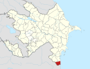
Photos • Location
38°26′31″N 48°52′55″E / 38.442°N 48.882°E
| Astarachay Astaraçay, آستاراچای | |
|---|---|
| Location | |
| Countries | Iran and Azerbaijan |
| Province | Gilan, Iran |
| District | Astara, Azerbaijan |
| Cities |
Astara, Iran Astara Azerbaijan |
| Physical characteristics | |
| Mouth | Caspian Sea |
| Length | 38 km (24 mi) |
| Basin size | 242 km2 (93 sq mi) |
The Astarachay ( Talysh: Ostororü, Persian: آستاراچای, Azerbaijani: Astaraçay), is a small river that defines the eastern border between Iran and Azerbaijan in Western Asia. [1]
The river discharges into the Caspian Sea. After flowing in a canyon through the Alborz mountain range, it reaches its river mouth on the southwestern Caspian coast.
The Astarachay is partially in Gilan Province of far northwestern Iran.
See also
External links
- Aerial Map: Astarachay
- Astarachay Archived 2013-07-22 at the Wayback Machine
References
Categories:
- Rivers of Gilan Province
- Rivers of Azerbaijan
- International rivers of Asia
- Tributaries of the Caspian Sea
- Alborz (mountain range)
- Landforms of Gilan Province
- Astara District
- Azerbaijan–Iran border
- Border rivers
- Astara District geography stubs
- Asia river stubs
- Europe river stubs
- Azerbaijan geography stubs
- Astara County geography stubs
- Iran river stubs

