Plai Phraya
ปลายพระยา | |
|---|---|
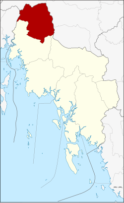
 District location in
Krabi province | |
| Coordinates: 8°32′0″N 98°51′46″E / 8.53333°N 98.86278°E | |
| Country | Thailand |
| Province | Krabi |
| Seat | Plai Phraya |
| Area | |
| • Total | 433.4 km2 (167.3 sq mi) |
| Population (6 November 2002) | |
| • Total | 35,434 |
| • Density | 81.8/km2 (212/sq mi) |
| Time zone | UTC+7 ( ICT) |
| Postal code | 81160 |
| Geocode | 8106 |
Plai Phraya ( Thai: ปลายพระยา, pronounced [plāːj pʰrā.jāː]) is a district ( amphoe) in Krabi province, Thailand.
Neighboring districts are (from the north clockwise): Phanom, Phrasaeng, Chai Buri (all Surat Thani province); Khao Phanom and Ao Luek of Krabi Province; and Thap Put of Phang Nga province.
Khlong Phraya Wildlife Sanctuary is on the Surat Thani Province border.
The minor district ( king amphoe) Plai Phraya was created on 15 June 1973, when the three tambons, Plai Phraya, Khao Khen, and Khao To, were split off from Ao Luek district. [1] It was upgraded to a full district on 12 April 1977. [2]
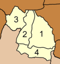
The district is divided into four sub-districts ( tambons), which are further subdivided into 33 villages ( mubans). Plai Phraya has township ( thesaban tambon) status, covering parts of tambon Plai Phraya. Each of the tambons is administrated by a tambon administrative organization (TAO).
|

|
- ^ ประกาศกระทรวงมหาดไทย เรื่อง แบ่งท้องที่อำเภออ่าวลึก จังหวัดกระบี่ ตั้งเป็นกิ่งอำเภอปลายพระยา (PDF). Royal Gazette (in Thai). 90 (67 ง): 1840. June 12, 1973. Archived from the original (PDF) on March 9, 2012.
- ^ พระราชกฤษฎีกาตั้งอำเภอปลายพระยา อำเภอห้วยเม็ก อำเภอละแม อำเภอแม่จริม อำเภอหนองกี่ อำเภอโคกปีบ อำเภอเกาะพะงัน อำเภอสนม อำเภอโซ่พิสัย อำเภอโนนสะอาด และอำเภอนาจะหลวย พ.ศ. ๒๕๒๐ (PDF). Royal Gazette (in Thai). 94 (31 ก): 326–330. April 12, 1977. Archived from the original (PDF) on December 3, 2008.