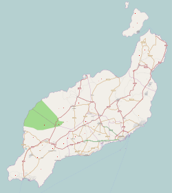
Photos • Location

Port of Órzola

Órzola | |
|---|---|
 Main street of Órzola | |
| Coordinates: 29°13′19″N 13°27′09″W / 29.22194°N 13.45250°W | |
| Country | |
| Autonomous Community | |
| Province | Las Palmas |
| Island | Lanzarote |
| Municipality | Haría |
| Population (2021)
[1] | |
| • Total | 352 |
| Time zone | UTC±00:00 ( WET) |
| • Summer ( DST) | UTC+01:00 ( WEST) |
| Postcode | 35541 |
Órzola is a village in the municipality of Haría on the island of Lanzarote in the Canary Islands. It is the northernmost settlement of the island. As of 2021, it has a population of 352 inhabitants. [1]

The port of Órzola is the departure point for the ferries to the island of La Graciosa. [2]
References
Wikimedia Commons has media related to
Orzola.
- ^ a b "Nomenclátor: Población del Padrón Continuo por unidad poblacional" [Nomenclátor: Continuous electoral roll population per settlement]. Instituto Nacional de Estadística (in Spanish). Retrieved 10 August 2022.
- ^ "Ferry from Lanzarote to La Graciosa". Visit La Graciosa. Retrieved 10 August 2022.
