Photos • Location
Érsekvadkert | |
|---|---|
 | |
| Country | |
| Region | Northern Hungary |
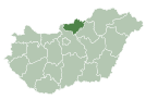
| County | Nógrád |
| District | Balassagyarmat |
| Government | |
| • Mayor | Dr. Attila Őszi Csaba ( Ind.) |
| Area | |
| • Total | 55.37 km2 (21.38 sq mi) |
| Population (2023) | |
| • Total | 3,415 |
| • Density | 62/km2 (160/sq mi) |
| Time zone | UTC+1 ( CET) |
| Area code | 35 |
You can help expand this article with text translated from
the corresponding article in Hungarian. (September 2017) Click [show] for important translation instructions.
|
Érsekvadkert is a village [1] in Nógrád County, Hungary with 3,526 inhabitants (2011).
References
- ^ "Google Translate". google.com. Retrieved 14 April 2015.
External links
- Official website (in Hungarian)
47°59′50″N 19°11′54″E / 47.997301°N 19.198412°E


